

A copy of a huge map of Falmouth drawn in 1690 which was presumed lost forever has resurfaced and been deposited with the Cornwall Record Office so that it can be made available to the public.
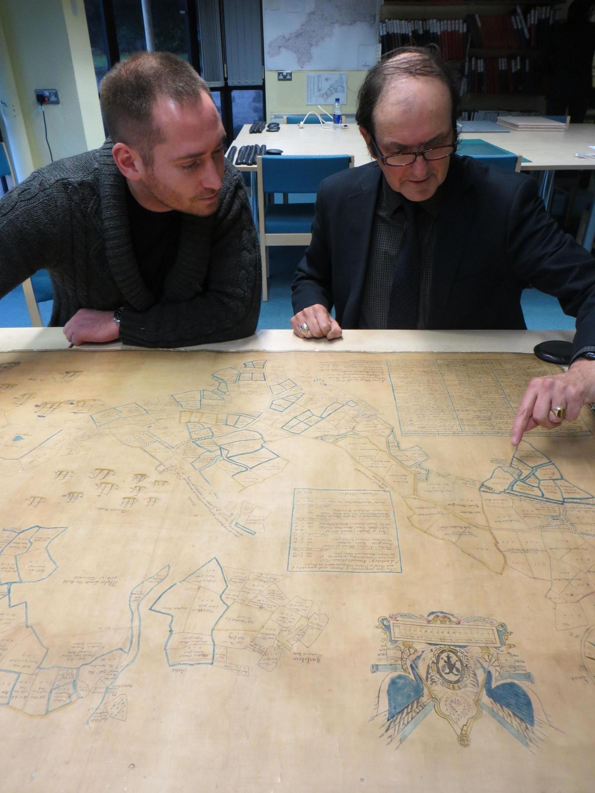
The map, which has never before been seen in public, was discovered in the private collection of historian Alan Pearson who died in June 2015.
David Thomas, archivist at Cornwall Record Office, said: “We are thrilled to now have on deposit this highly important map of the Falmouth area, drawn by local mapmaker George Withiell. It is one of the most significant early Cornish maps to emerge into the public domain in recent years and we are delighted to have it in our collections, where it will help researchers further understand the growth and development of Falmouth.”
Local historian Tom Weller, who located the map, had been working closely with Alan for several years, assisting with the completion of Alan's detailed two-volume history of the town, entitled Smithick to Falmouth.
Tom said: "Because of our shared interest in the town’s history, after Alan’s death his family asked if I might look through his private collection of Falmouth material and advise on which archive it should go to. I remember being shown Alan's study and spotting a large old map rolled up in the corner. I carefully opened it and was amazed by what I saw. There in front of me was a map of the town, dated 1690, that everyone had presumed was lost."
The large map, which is titled A True Map of all Sir Peter Killegreew’s Lands in the Parish of Mylor and part of Budock Lands, was commissioned by the Killigrew family in 1690 to better record the extensive land they held. The new town of Falmouth was rapidly expanding, and a reference map was required to keep track of its growth. It was drawn by a local surveyor called George Withiell, who produced plans for many 17th century estate owners in the west country.
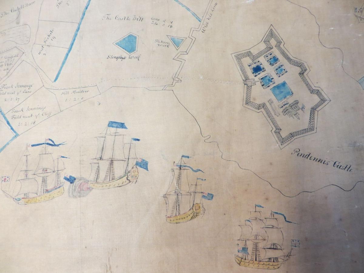
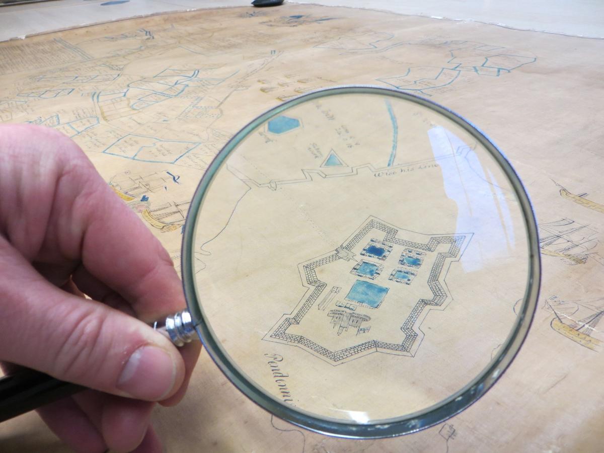
The detailed map shows the open land upon which Falmouth is now built, including the names of all the fields and meadows stretching out to Bickland Water Road; a large area of land in Mylor is also included, as the Killigrew family still held tenements there in the 17th century. Farmsteads at Tregenver, Trescobeas, Tregonniggie and Gyllyngvase are also shown in detail, as well as the fortifications at Pendennis.
Alan’s widow, Mollie, explained how the map came into Alan’s possession: “Alan always looked out for rare items to do with Falmouth, and about ten years ago he saw the map for sale in the catalogue of a well-respected manuscript dealer in Bristol. I remember he didn’t mention how much he paid for it - we each had our own hobbies - but he was extremely excited by his find.”
The map was last seen in the 1880s, when it was kept at the Wodehouse family’s estate office at Arwenack. However, it is not known when or how the map left Arwenack and ended up in Bristol.
Having seen the map, and concerned that it could disappear into another private collection, Tom suggested transferring the important item to Cornwall Record Office, in Truro, where it would be publicly available. Alan’s children, Clare and James, wholeheartedly agreed and it is now possible for everyone to make the most of this priceless document for the first time in living memory.
Mollie said: "Alan was so passionate about the history of Falmouth, and of course Cornwall in general. It's a lovely legacy that the map is now safely stored in its rightful place; somewhere safe where its long-term security is assured and other people can make the most of the information it contains. I know Alan would be delighted by this result."
Information about visiting the Record Office can be found at www.cornwall.gov.uk/cro. The map is referenced as X1432/1.


Comments: Our rules
We want our comments to be a lively and valuable part of our community - a place where readers can debate and engage with the most important local issues. The ability to comment on our stories is a privilege, not a right, however, and that privilege may be withdrawn if it is abused or misused.
Please report any comments that break our rules.
Read the rules here