
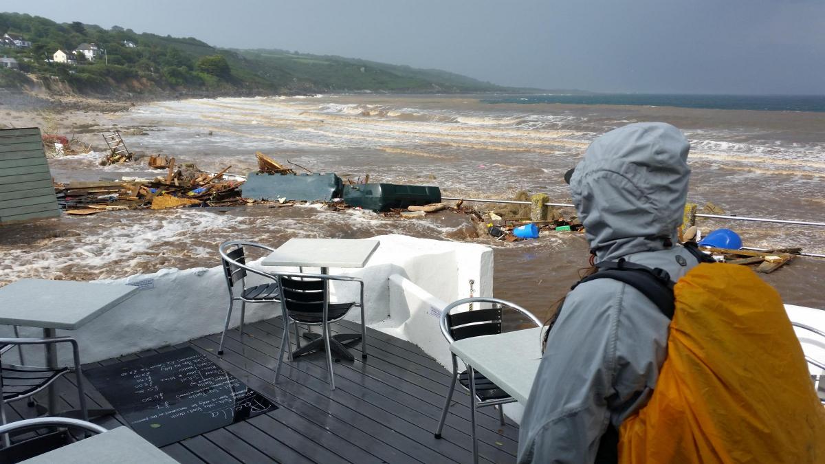
FLOODING which tore through the village of Coverack leaving damage in its wake was caused by what could have been the most intense rainfall ever recorded in the UK.
The claim was made by flooding experts at Cornwall Council during a meeting at County Hall on Thursday.
Flash-flooding struck the coastal village on July 18, 2017, and flooded 50 properties and ripped apart roads.
Intense rainfall fell over a short period and then washed through the village wreaking havoc.
Experts at County Hall said the level of rainfall at Coverack was similar to – but faster than – that experienced in the Boscastle floods in 2004 which led to the village being evacuated.
Dave Watkins, flood and coastal environment lead at Cornwall Council, told the neighbourhoods overview and scrutiny committee: “Coverack had the same amount of rainfall as Boscastle but it happened in half the time.
“The Coverack rainfall was probably the most intense rainfall ever recorded in the UK.”
Mr Watkins made the comments in a presentation about the flooding and coastal erosion risk management annual report which covers the period of July 2017 to June 2018.
The report describes the Coverak floods as : “An extremely intense rainfall of about 200mm in three hours occurred in the area of Coverack. This was possibly the most intense storm ever recorded in the UK. In Coverack itself around 50 properties flooded, the road through the village was destroyed and a landslide caused the loss of the coast path. In neighbouring St Keverne eleven properties flooded, one flooded at Porthallow and flood damage also occurred in Porthoustock.”
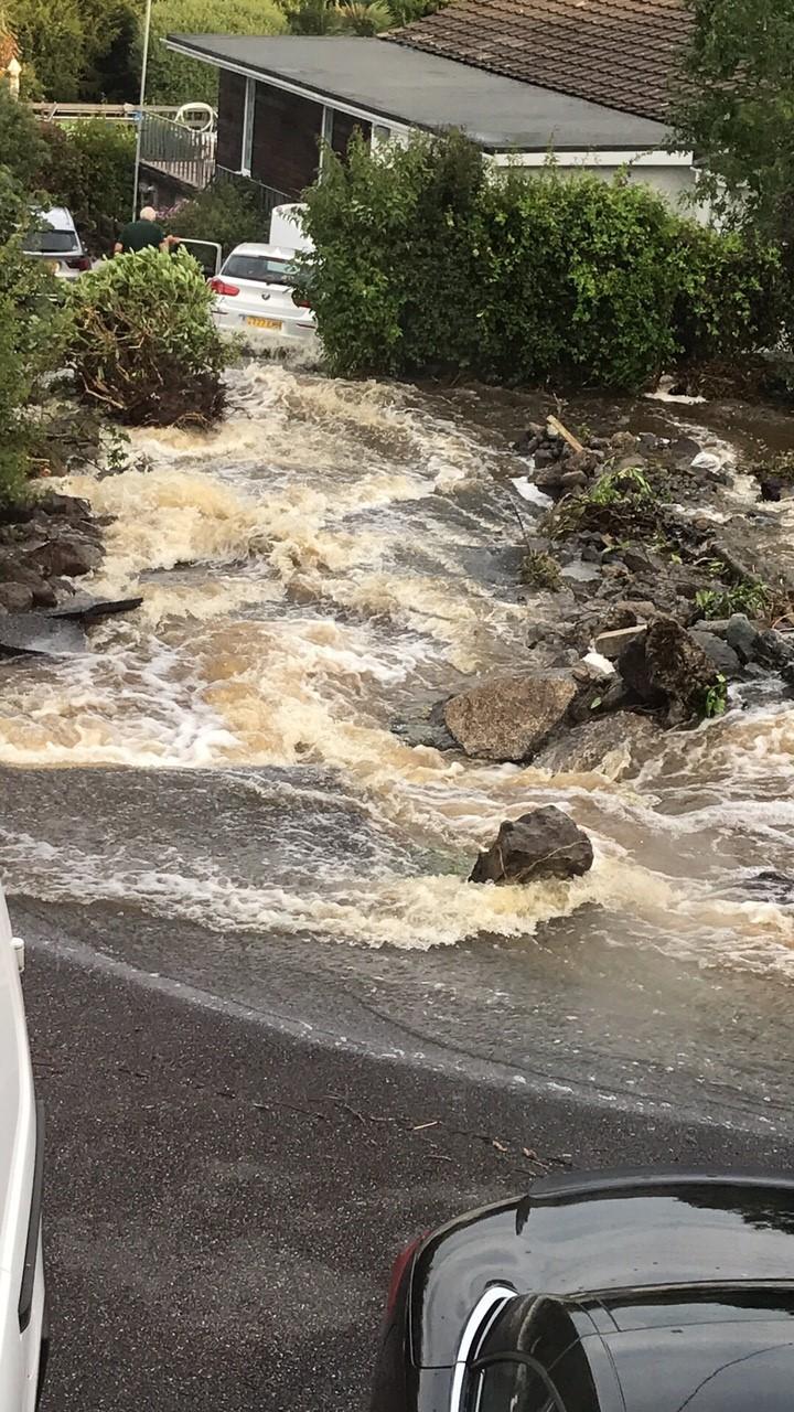
Other flood incidents between July 2017 and June 2018 are also detailed in the report including a flood in September 2017 in Polperro which saw a strange reason for the drains being blocked.
The report states: “Very heavy rainfall led to a deluge of water flowing in the streets of Polperro. There were reports of potators being washed out of fields and blocking drains in the village. Fire and rescue services attended a number of incidents to rescue people trapped in cars in floodwater.”
More details are also revealed about damage which was caused by Storm Eleanor in January this year.
Newquay, St Ives and Portreath all saw significant damage and the report adds: “At Loe Bar the outlet tunnel collapsed and the Environment Agency mobilised their heavy duty pumps to reduce water levels in Loe Pool, protecting 120 homes in Helston against flooding.
“The aftermath of Storm Eleanor resulted in ‘cliffing’ of beach sand dunes along the north coast resulting in vertical sand cliffs up to 10 metres high. This particularly affected Perranporth, Crantock and Bude where Summerleaze Beach was closed to the public due to safety concerns. In Porth approximately 300 tonnes of sand engulfed a commercial premise.”
The detailed report also includes stats for the number of homes that have been flooded since 2011. This shows that in 2011 24 homes were flooded while in 2012 that jumped to 243.
It dropped again in 2013 to 83 homes but in 2014 it was one of the highest ever levels at 329. In comparison 2015 saw no homes flooded at all.
In 2016 there were 103 homes flooded in Cornwall and in 2017 there were 86. This year to April there have been 17 homes flooded.


Comments: Our rules
We want our comments to be a lively and valuable part of our community - a place where readers can debate and engage with the most important local issues. The ability to comment on our stories is a privilege, not a right, however, and that privilege may be withdrawn if it is abused or misused.
Please report any comments that break our rules.
Read the rules here