
MANY areas of the south coast of Cornwall could be under sea level in 30 years’ time, according to new data.
Not-for-profit organisation Climate Central has published a new tool allowing residents to see if their streets could be underneath the current sea level by 2050.
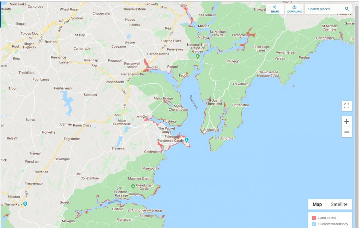
And the interactive map shows that areas including Falmouth, Penryn and Flushing will be at risk of being underwater in line with rising sea levels caused by climate change.
Interactive map: Find out which parts of the coast are most in danger
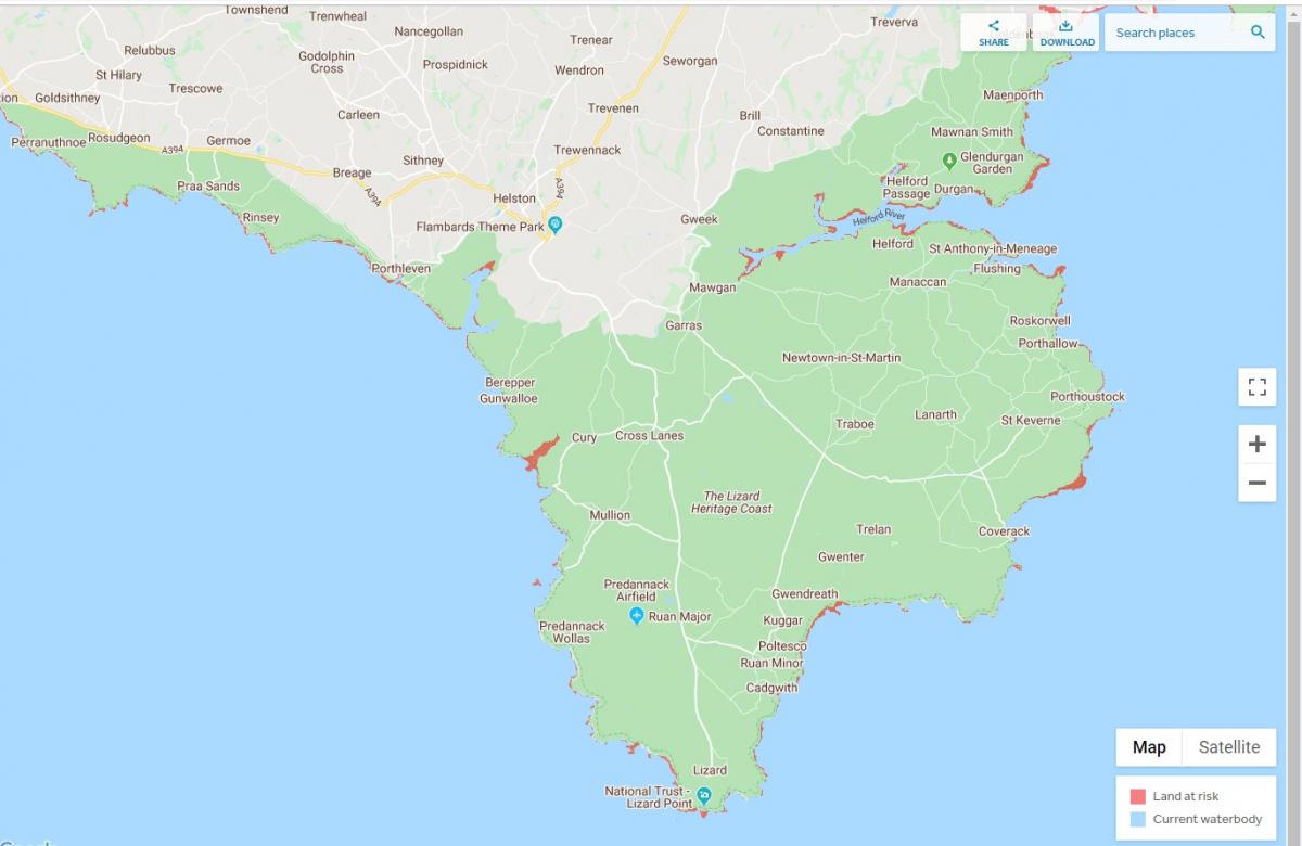
On the Lizard Peninsula, danger areas are at Gunwalloe Church Cove Beach, Mullion Island, Kennack Sands and Kynance Cove.
A spokesman for Climate Central said: "Areas shaded red reflect places that are lower than the selected local sea-level or coastal flood projection, according to the selected elevation dataset.
"Red areas must also meet hydrologic connectivity criteria."
A hydrologic warning is the ability to warn of imminent danger to life, property, and the environment from hydrologic disasters, through the use of automated remote data collection networks.
The spokesman continued: "This refined bathtub approach makes mapping numerous scenarios fast and efficient and reproduces potential future sea-level threats well.
"However, when coastal floods are added, the bathtub approach becomes less accurate, the higher the flood.
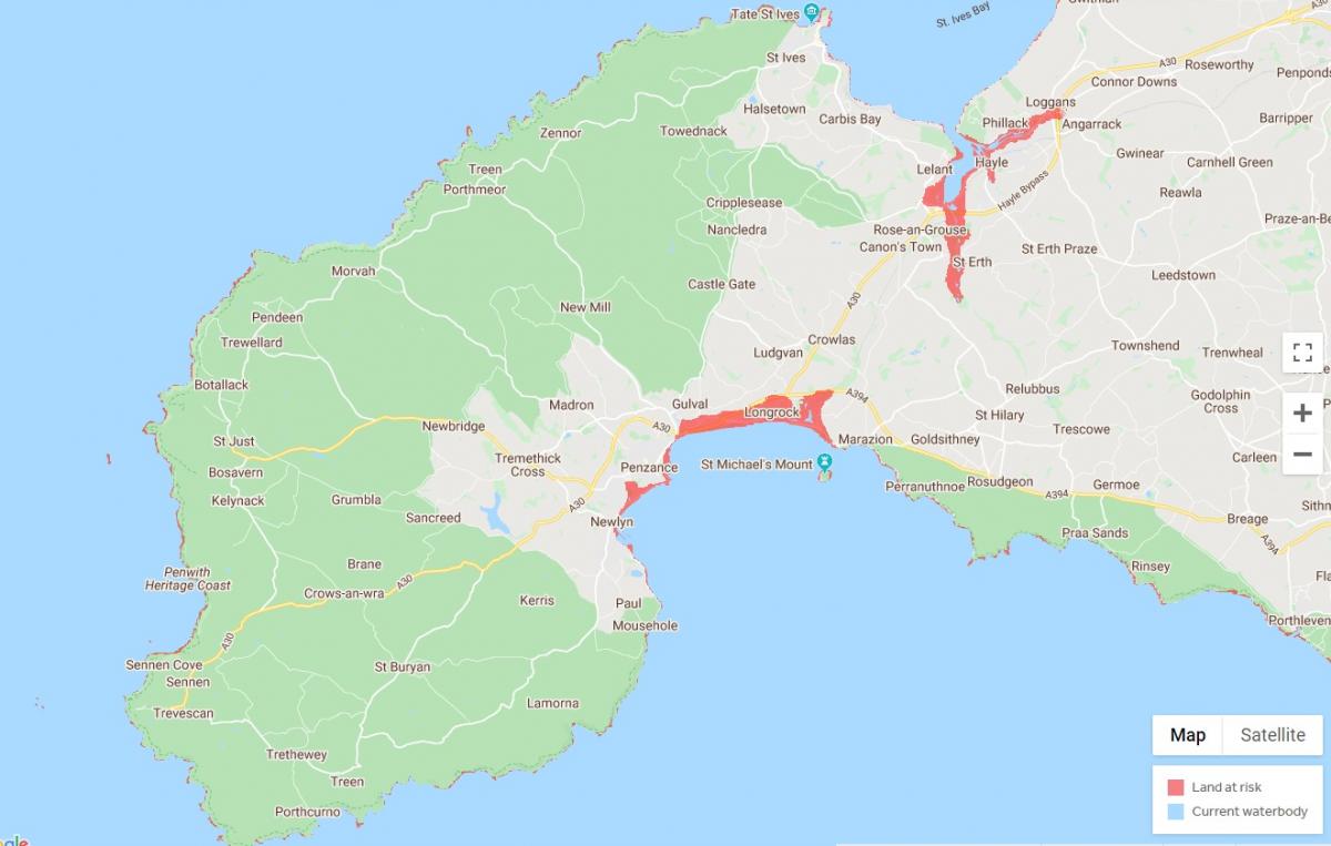
Further along the coast into Mount's Bay, Longrock, which overlooks St Michael's Mount, looks especially vulnerable, as do parts of Hayle, Lelant and St Erth on the north coast.
A spokesman from the Environment Agency said: "The Environment Agency forecasts sea level rises for the next 100 years to assist with domestic, commercial and specialised planning.
"Using the high-end forecasts, the maximum level the sea could rise would be 2.2m by the end of 2115. Even with this scenario, we do not foresee the geography changing within Cornwall as you described and we cannot speculate beyond our current projections.
"Our normal climate change scenarios which we use for typical domestic and commercial planning are more modest than that.
"But it is worth noting that even with these estimates there will be significant coastal change in our area and we have mapped out these scenarios in the relevant Shoreline Management Plan."


Comments: Our rules
We want our comments to be a lively and valuable part of our community - a place where readers can debate and engage with the most important local issues. The ability to comment on our stories is a privilege, not a right, however, and that privilege may be withdrawn if it is abused or misused.
Please report any comments that break our rules.
Read the rules hereLast Updated:
Report this comment Cancel