

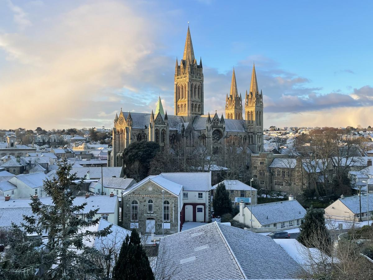
Doesn’t she wear it well! @TruroCathedral in the #snow ❄️❄️❄️ pic.twitter.com/GRGfYWUiuF
— Esme Page (@esmepage) January 18, 2024
Snow is reported to have fallen across parts of Cornwall this morning as a weather warning for snow and ice remains in force.
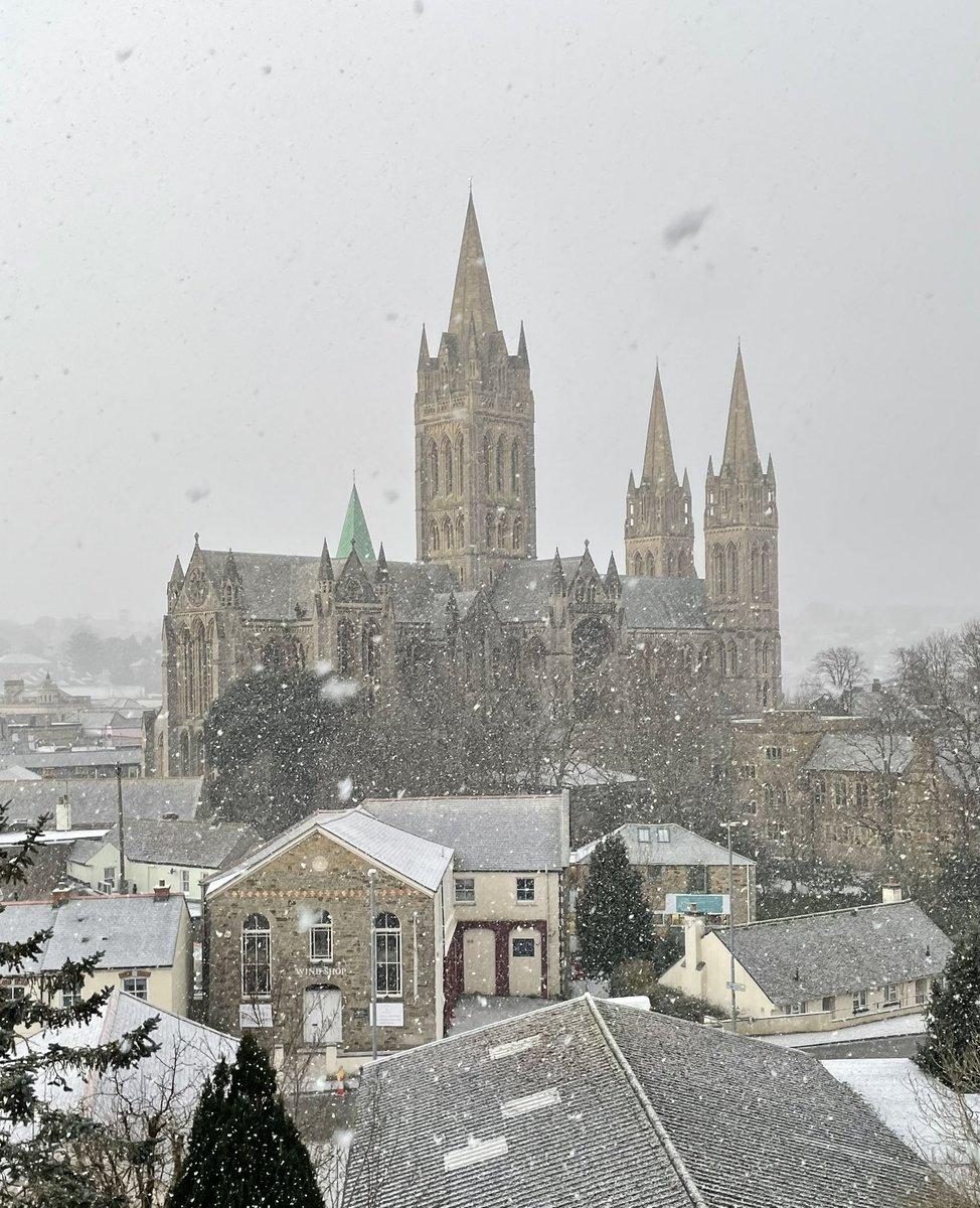
Stunning but slippery - take care peeps! @TruroCathedral @BBCCornwall #snow #Truro pic.twitter.com/Qh2cDtKbhp
— Esme Page (@esmepage) January 18, 2024
Snow has have been reported all over Cornwall including Hayle, St Ives, Truro, Mylor Bridge, Penzance and other parts of Cornwall.
Less than a handful of schools are reported closed by Cornwall Council: Gulval School, Humphry Davy School, St Ives School - opening late 10.30am.
Go Cornwall Bus report there are delays across the network this morning due to ICE and Snow especially along the North Coast area.
"Drivers will do there upmost to keep services running Safely so may be taking extra time and care on untreated surfaces to get you safely to your destination."
0845
— Go Cornwall Bus (@GoCornwallBuses) January 18, 2024
There are delays across the network this morning due to ICE and Snow especially along the North Coast area. Drivers will do there upmost to keep services running Safely so may be taking extra time and care on untreated surfaces to get you safely to your destination. pic.twitter.com/cQOh6A5JdP
Many people are posting on social media their pictures and videos of the first snowfall in Cornwall for 2024.
Snow in West Cornwall this morning. Very unusual. ☃️🌨️❄️ pic.twitter.com/EkWtU6INVo
— Nicola Bailey 💙🌈 (@nicolab03) January 18, 2024
The Met Office weather warning for snow and ice remains in force until 11am this morning with people advised to take care whilst driving.
A Met Office spokeswoman said the low temperatures are also due to how long the cold snap has lasted.
She said: “It’s due to the prolonged nature of this cold spell, it will have been lasting for quite a few days.
“A build up of snow, as well, just allows for the temperatures to get colder and colder and we don’t often see a cold spell last three to five days.
“The air is coming directly from the Arctic, so it is exceptionally cold air.
“It’s staying cold until Friday, and then looking further ahead into the weekend we’ve got some deep areas of low pressure pushing in, so a big change in weather type, and we could see some stormy conditions by the end of the week.
“The cold isn’t lasting right to end of the week, but we have a very different type of potentially-disruptive weather arriving.”
The weather is forecast to turn stormy on Sunday with another yellow weather warning for wind, she added. A period of strong winds may bring disruption to travel and utilities across parts of the UK including Cornwall.
A period of strong winds and persistent rainfall is expected across parts of the UK during Sunday.
Whilst there is still some uncertainty as to the exact locations which will see the strongest winds, northern and western areas are likely to be most at risk.
Many inland areas are expected to see gusts of 50 - 60 mph during this period. Coasts and exposed locations could see gusts of 60 - 70 mph or even higher.


Comments: Our rules
We want our comments to be a lively and valuable part of our community - a place where readers can debate and engage with the most important local issues. The ability to comment on our stories is a privilege, not a right, however, and that privilege may be withdrawn if it is abused or misused.
Please report any comments that break our rules.
Read the rules here