
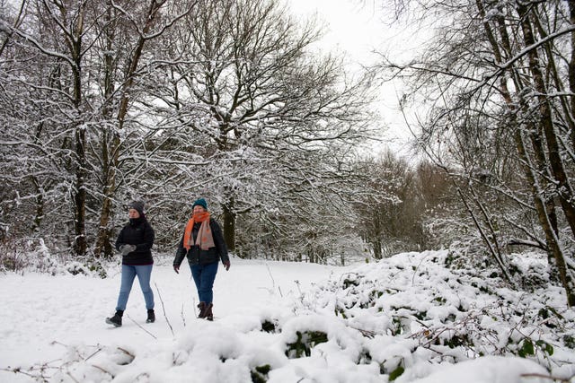
Forecasters have warned that snow could cause disruption to parts of the UK on Tuesday amid further weather warnings issued for later on this week.
A yellow weather warning of snow for parts of Scotland and northern England came into force at 11am on Tuesday. It is expected to last until midnight.
The Met Office has said that hill snow may lead to travel disruption, warning that roads and railways are likely to be affected, with the most prolonged hill snow coming north of the Central Belt in Scotland.
Met Office spokeswoman Nicola Maxey told the PA news agency: “We’re looking at two to five centimetres in some areas – above 400 metres we could see five to eight, or five to 10 centimetres.”
⚠️Yellow Warning updated ⚠️ #Snow across parts of Scotland, northern England and the Midlands
Tuesday 1100 – 2359
Latest info 👉 https://t.co/QwDLMfRBfs
Stay #WeatherAware⚠️ pic.twitter.com/lpi0RMJgCb
— Met Office (@metoffice) January 26, 2021
“It is not the sort of amount we are likely to see on Thursday.”
Another yellow weather warning of snow has been issued for all of Thursday and into Friday morning across parts of Scotland and northern England, warning of potential heavy snowfall on hills in these regions.
“Some of those snowfall amounts can build up, so we could see a significant, prolonged snowfall throughout Thursday, with the potential of 15 to 30cm accumulating over some of the highest areas,” Ms Maxey said.
This could cause travel disruption to trains on high routes, while motorists may also be faced with delays.
It comes after the Met Office said the UK had experienced its snowiest spell over the weekend since late January 2019, when 20 weather stations in England recorded accumulations of 5cm or more for three days consecutively.
Separately, a yellow warning of rain has been issued for a 24-hour period on Thursday for the North West of England, which saw flooding during wet weather caused by Storm Christoph last week.
“We’re looking at 20 to 30 centimetres of rain quite widely in that warning area, and 50 to 60 centimetres over the hills,” Ms Maxey added.
“Although over that time it’s perhaps not impactful rain, but because it’s falling on already wet ground, there is a potential it could have some impacts.”
Some 19 flood warnings and 49 flood alerts remained in place across England as of 12pm on Tuesday, with the more serious warnings covering parts of the River Ouse and the River Derwent in North Yorkshire.
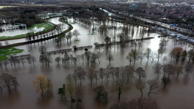
Meanwhile, flood warnings were in place for the River Severn in parts of Gloucestershire and Worcestershire.
Temperatures are expected to stay above freezing in southern and central England on Tuesday evening, but parts of northern England could see chillier conditions.
“We’ve got some mild air for the southern half of England, and this colder air further north,” Ms Maxey said.
“What we are seeing on Wednesday into Thursday with this weather front is it’s rain as it comes into the UK, and as it pushes north-east it bumps up against the cold air, and that’s when the rain turns to snow.”
Temperatures are set to plummet going into the weekend, she added, which will be more settled with drier, sunnier weather for much of the UK.


Comments: Our rules
We want our comments to be a lively and valuable part of our community - a place where readers can debate and engage with the most important local issues. The ability to comment on our stories is a privilege, not a right, however, and that privilege may be withdrawn if it is abused or misused.
Please report any comments that break our rules.
Read the rules here